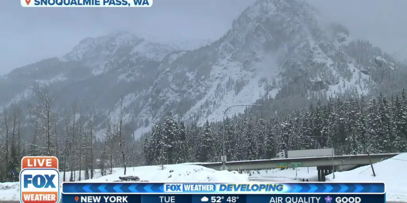
As of March 11, 2026, the Cascade Mountains are bracing for a significant weather event with a heavy snow warning in effect, particularly affecting key mountain passes like Snoqualmie Pass, Stevens Pass, and White Pass. This weather event highlights the unpredictable nature of mountain weather, even as spring approaches and the region typically begins to see milder conditions.
The winter storm warning issued by the National Weather Service anticipates up to 15 inches of snow and dangerous conditions, including gusty winds and rainfall.
The most severe impacts are expected at elevations between 3,500 and 4,500 feet, where accumulations of 8 to 14 inches of snow are forecasted. This severe weather will particularly affect Stevens Pass, Snoqualmie Pass, and White Pass. Travelers are advised to exercise extreme caution, with significant delays and near-whiteout conditions expected on major roads, including Interstate 90 and Highway 2.
Preparations for the storm are underway, and authorities are urging residents and travelers to take necessary precautions. Winter storm kits, including items like tire chains, booster cables, flashlights, shovels, and extra clothing, are recommended for anyone planning to travel through the affected areas.
For those in the Snoqualmie Pass area, weather alerts and advisories are being closely monitored. These advisories and watches, which were initially posted, could easily be upgraded to more severe warnings as the storm progresses.
In summary, the current heavy snow warning and winter storm warning for the Cascade Mountains underscores the need for vigilance and preparedness. As the storm unfolds, residents and travelers should stay informed and follow the advice of local authorities to ensure safety.