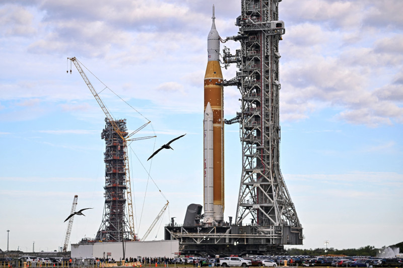
Imagine the sudden howl of wind and the chilling realization that a tornado is bearing down on your city. In moments like these, technology becomes your lifeline. For those living in Indianapolis, tornado radar systems stand as the frontline defense, offering real-time data that could save lives. But how does this technology work, and why is it so crucial for tracking severe weather in and around the city?
The Science of Tornado Radar: Decoding Nature's Fury
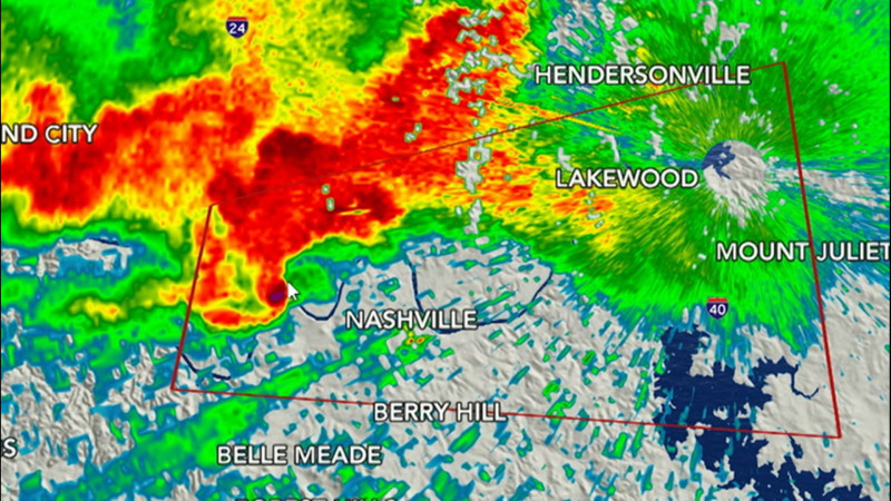
At its core, a tornado radar uses sophisticated technology to detect and track storm systems. Doppler radar, a key component, emits microwave pulses that bounce off precipitation particles, providing detailed information on wind speed and direction. This allows meteorologists to pinpoint the formation of tornadoes and predict their paths with unprecedented accuracy. As tornadoes form within supercell thunderstorms, the radar's ability to detect wind patterns within these storms is invaluable. In Indianapolis, where severe weather can strike with little warning, this precision is critical. It's not just about spotting the storm; it's about giving residents the time to seek shelter before it's too late. The Weather Channel and Weather.com offer interactive maps that allow users to zoom in on their neighborhoods, providing a hyper-local view of weather conditions. This means that whether it's rain or a deadly funnel cloud, Indianapolis residents can have a clearer picture of what's approaching.
Real-Time Tornado Radar in Action: Staying Ahead of the Storm
In the heart of Indianapolis, real-time tornado radar systems are more than just tools; they are life-savers. Stations like FOX59 and WISH-TV provide live updates and Doppler radar maps, enabling residents to track storms as they move across the city. These systems update frequently, sometimes every minute, ensuring that even the slightest changes in a storm's path are captured. This level of detail is crucial as tornadoes can form rapidly and change direction without warning. The National Weather Service (NWS) Forecast Office in Indianapolis enhances this effort by providing comprehensive forecasts and alerts. Their radar maps offer a detailed view of current weather conditions, making them an essential resource for both residents and emergency services. Think about the power of knowing that a storm is shifting its path just enough to miss your neighborhood. That's the impact of real-time tornado radar. But remember, these systems are only as effective as our preparedness. Local emergency managers and weather experts stress the importance of having a plan and staying informed.
Living with Unpredictable Weather: What to Expect in Indianapolis
Tornado radar technology offers a vital layer of protection, but it also brings a sense of urgency. When it comes to severe weather, the key is preparation. Indianapolis residents are encouraged to stay tuned to local weather updates, especially during storm seasons. Most tornadoes in this region occur in the spring and summer, but they can happen anytime. ABC Channel 6 and WRTV offer interactive maps that show the latest storm, rain, and snow patterns, ensuring that residents are prepared for any weather event. While the unpredictability of tornadoes can be daunting, the technology available today provides a beacon of hope. Can you imagine a world where every home in Indianapolis has access to real-time radar data, making storm preparedness as routine as checking the weather forecast? The future of tornado radar isn't just about tracking storms; it's about creating a community that's always one step ahead.
“The best way to stay safe during a tornado is to be aware, be prepared, and be able to seek shelter immediately. Tornado radar gives us that crucial window of time.”