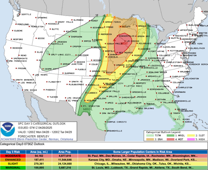
A dangerous severe weather outbreak is unfolding across Minnesota, with the Storm Prediction Center warning of a rare Level 4/5 risk for destructive storms Monday afternoon and evening. Minneapolis and southern Minnesota face the highest danger, including potential long-track tornadoes, baseball-sized hail, and wind gusts over 70 mph
The National Weather Service stresses this is an unusually high-risk scenario for late April, with warm, unstable air colliding with a powerful jet stream. Twin Cities residents should prepare for two storm waves: scattered afternoon storms could rapidly intensify into rotating supercells, followed by a second round of damaging winds overnight
Critical details:
-
Timing: Peak threat 3-9 PM Monday, lingering risks overnight
-
Main hazards: Strong tornadoes (EF2+ possible), hail exceeding 3 inches, widespread 60-80 mph winds
-
Preparations: Charge devices, secure outdoor items, and identify shelter locations now
Meteorologists emphasize that even short-notice tornadoes could develop as storms fire along a dryline in western Minnesota before racing northeast The last comparable outbreak in the region occurred during April 2023's historic tornado swarm.
Residents should monitor NOAA Weather Radios and local broadcasts, as some tornadoes may develop with limited warning due to the storm speed