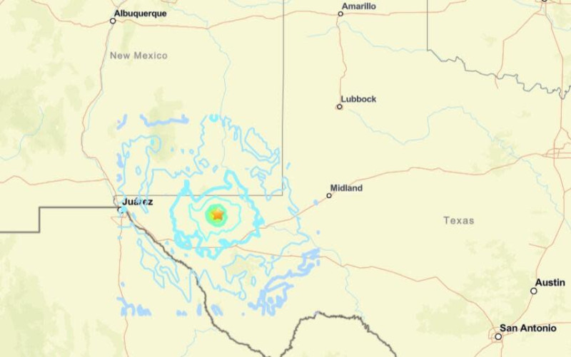
A strong earthquake shook West Texas and the surrounding region Saturday evening, sending tremors through El Paso, southeastern New Mexico, and northern Mexico. The quake, recorded at 7:47 p.m. MT, registered a magnitude between 5. and 5. according to the U.S. Geological Survey, with the epicenter located in Culberson County, about 125 miles east of El Paso and 35 miles south of Whites City, New Mexico
Residents across El Paso and Ciudad Juárez reported noticeable shaking, with some describing it as the longest and strongest quake they’ve felt in the area. Minor damage was reported, including cracks in cement foundations, but no serious injuries or widespread destruction have been confirmed Emergency officials in Eddy County, New Mexico, stated that while the quake was widely felt, there were no immediate calls for damage
The earthquake struck at a shallow depth of approximately 4 miles, increasing the intensity of ground shaking. Two smaller aftershocks, both around magnitude 2.9, followed the main event
This is the most significant earthquake to hit the region since 202, and while rare, it highlights ongoing seismic activity along the Texas-New Mexico border No tsunami risk has been identified, and authorities continue to monitor for aftershocks.
Did you feel the earthquake in your area? Share your experience or ask about aftershock risks.