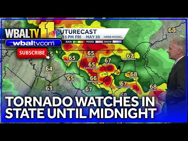
Severe weather swept across Maryland and the D.C. region Friday evening, triggering tornado watches and warnings for much of the state and neighboring Virginia. The National Weather Service issued a tornado watch for all of Maryland, Northern Virginia, and D.C. until midnight, with multiple tornado warnings following as storms intensified..
A tornado watch means conditions are favorable for tornadoes to develop, but no tornado has been spotted yet. Residents should stay alert and be ready to act. A tornado warning, however, is more urgent—it’s issued when a tornado has been sighted or indicated by radar, and immediate shelter is necessary.
Friday’s storms brought damaging wind gusts up to 65 mph, large hail, and torrential rain, leading to flash flood warnings in central Maryland through early Saturday morning Power outages affected thousands, and airport delays were reported throughout the region as the severe weather moved through.
The most intense storms were concentrated in central and southern Maryland, with additional warnings for counties in Northern Virginia. While the worst of the storms exited overnight, showers lingered into Saturday, keeping the flood risk elevated Warmer, sunny weather is expected to return by Sunday.