A surge of wildfires across central and western Canada is sending thick smoke into the United States, significantly deteriorating air quality in the Midwest, including Michigan. As of early June, more than 160 active wildfires are burning in provinces such as Manitoba, Saskatchewan, and British Columbia, with Manitoba and Saskatchewan recently declaring states of emergency due to the escalating crisis.
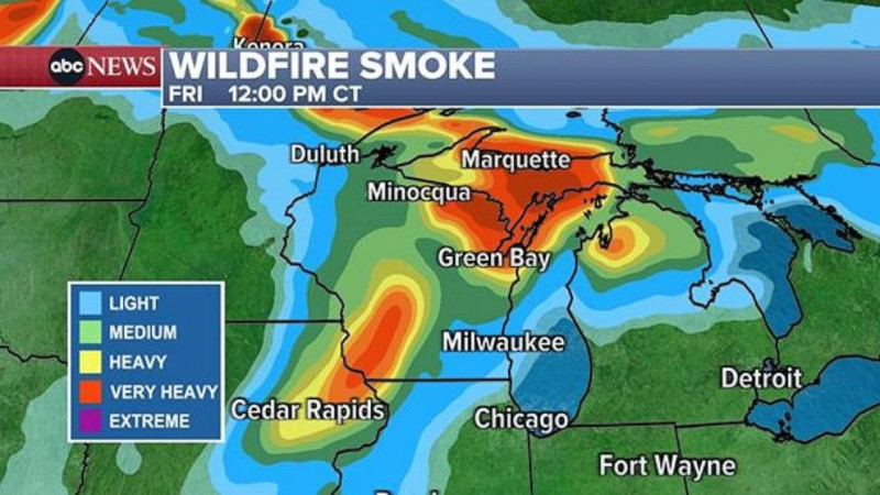
Interactive wildfire maps from Canadian and U.S. agencies show that the largest and most intense fires are concentrated northwest of Winnipeg and across northern Saskatchewan, just above the U.S. border These out-of-control blazes are producing vast smoke plumes that have drifted south, blanketing states like Minnesota, Wisconsin, Iowa, Illinois, Indiana, and Michigan in haze.
Air quality maps indicate that cities in Michigan and neighboring states are experiencing "unhealthy" to "very unhealthy" conditions, with the highest pollution levels recorded in areas directly under the smoke plume The AirNow.gov map currently displays large swaths of orange, red, and even purple, signaling increased health risks, especially for sensitive groups.
Officials warn that multiple waves of smoke are expected to persist into early June, and evacuations continue in affected Canadian communities. With.7 million acres already burned in Manitoba and Saskatchewan alone, the wildfire season is off to a dangerous start, and experts caution that changing weather could further influence fire behavior and smoke patterns in the coming weeks.