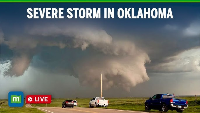
Oklahoma City is once again on high alert as tornado warnings and severe weather sweep across the region. Early Friday, the National Weather Service issued urgent alerts for central and northern Oklahoma, with residents in Osage and Pawnee counties ordered to take cover immediately due to a powerful thunderstorm exhibiting rotation and the potential to produce large hail and tornadoes.
Storms tracked eastward at speeds of up to 35 mph, prompting emergency officials to warn that airborne debris could be a serious hazard for anyone caught outdoors. Communities like Ralston and Fairfax were directly in the storm’s path, with residents urged to seek shelter in basements or interior rooms on the lowest floor of sturdy buildings.
The severe weather threat is not over. Meteorologists predict additional rounds of storms through Saturday and into the weekend, with the risk of damaging winds, flash flooding, and more tornadoes remaining high for the Oklahoma City metro and surrounding areas Power outages and property damage have already been reported in several counties, and the threat of repeated heavy rainfall could lead to totals exceeding three inches in some locations by the end of the weekend.
Officials continue to urge vigilance, advising everyone in the OKC area to monitor weather alerts, have emergency plans ready, and avoid travel during severe conditions. The pattern of storms is expected to persist, keeping Oklahoma firmly in the crosshairs of tornado season.
