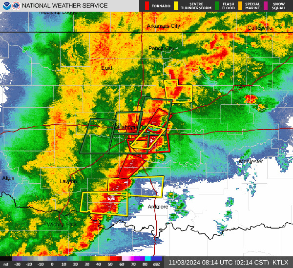
Severe weather swept across Oklahoma City Sunday evening, prompting multiple tornado and severe thunderstorm warnings for the metro and surrounding counties. Winds reached up to 60 miles per hour in parts of the southwest metro, with flash flood warnings issued for Blaine, Caddo, Canadian, Custer, and Dewey counties lasting into early Monday morning.
The National Weather Service highlighted a continued risk for damaging wind gusts, large hail, and isolated tornadoes, especially in central and southwestern Oklahoma. Residents in Oklahoma, Cleveland, Canadian, and Grady counties were urged to seek shelter as storms intensified late Sunday.
Powerful thunderstorms also knocked out electricity for thousands and brought the threat of hail larger than baseballs. The severe weather pattern is expected to linger, with the risk of strong storms and tornadoes shifting eastward through Monday.
Local meteorologists from KOCO and News advised the public to remain alert, monitor live radar updates, and have a safety plan ready as additional rounds of storms are possible. The active weather is forecast to continue into the week, keeping Oklahoma residents on high alert for further tornado and severe thunderstorm warnings.
