Unprecedented Super El Niño Could Drench San Antonio This Winter

San Antonio residents are bracing for a dramatic shift in weather patterns as a powerful El Niño system strengthens, promising a wetter, cooler winter than usual. The latest forecasts hint at a record-breaking event that could reshape the San Antonio weather landscape, with implications far beyond the usual seasonal changes.
Super El Niño: A Weather Phenomenon of Epic Proportions
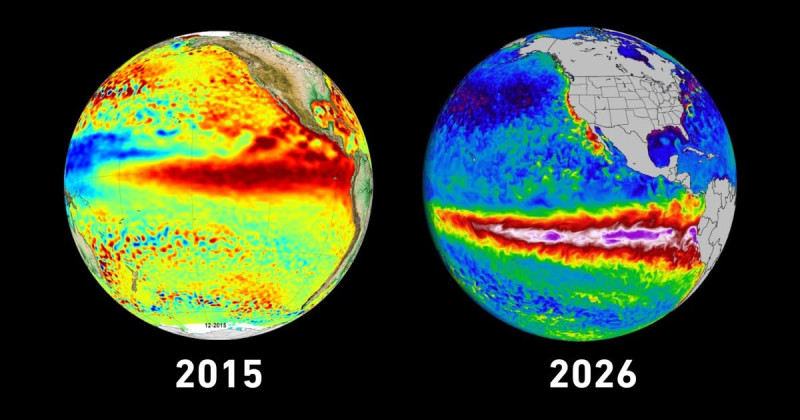
El Niño, the climate phenomenon characterized by unusually warm ocean temperatures in the equatorial Pacific, is currently strengthening to unprecedented levels. Forecasters are warning that this year's event could be the strongest on record, bringing with it a cascade of weather impacts for San Antonio and the broader South-Central Texas region.
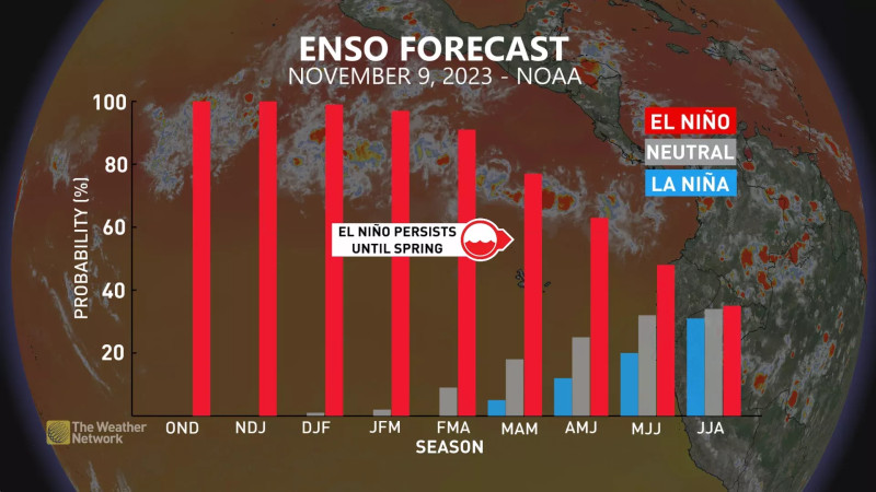
This El Niño is not just any weather event; it's a super El Niño, a term that has been gaining traction in recent times due to its potential to cause extreme weather conditions. The Climate Prediction Center (CPC) predicts that this event will likely persist through the winter of 2026-27, bringing significant changes to temperature and precipitation patterns.
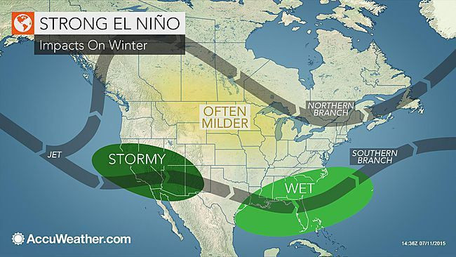
For San Antonio, a strong El Niño typically translates to wetter and cooler conditions, a stark contrast to the recent mild summer. This year, the forecast is even more intense, with an increased likelihood of flooding rains and other severe weather events.
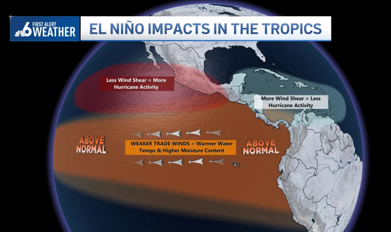
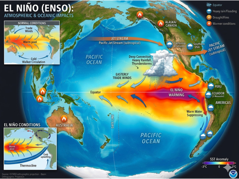
The Pacific Ocean's warm phase, known as El Niño, is part of the wider El Niño-Southern Oscillation (ENSO) cycle. This cycle, which includes both El Niño and its counterpart La Niña, can have profound effects on global weather patterns, including those in South-Central Texas.
Weather Forecasts: What to Expect in San Antonio
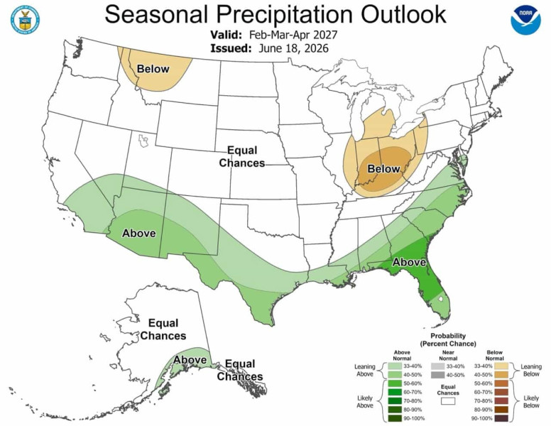
What does all this mean for San Antonio residents? The forecast is clear: brace for a wet winter. The San Antonio weather outlook for the upcoming months includes a greater likelihood of heavy rainfall, cooler temperatures, and a higher risk of flooding. The usual fall and winter seasons could be particularly tumultuous, with weather patterns that defy the norm.
Forecasters are particularly concerned about the potential for record-breaking rainfall. A strong El Niño could bring more precipitation than the region has seen in decades, with the potential for widespread flooding and other weather-related issues.
The National Oceanic and Atmospheric Administration (NOAA) has issued a warning that a strong El Niño could lead to disruptive weather conditions across the region. The potential for flooding is particularly high, with the likelihood of heavy rainfall increasing significantly.
As the event unfolds, residents are advised to stay vigilant and prepare for the possibility of extreme weather conditions. This includes ensuring that homes are secure against potential flooding and staying informed about local weather updates.
"We're in Uncharted Weather Territory"
Think again. Nobody saw this coming.
According to experts, this El Niño is like nothing we’ve seen before. Andrea Torralba, a meteorologist with the Climate Prediction Center, says, “We're in uncharted weather territory. The strength of this El Niño is unprecedented, and while we have historical data to guide us, the sheer magnitude of this event means we could be seeing weather patterns that are entirely new.”
“San Antonio residents should expect the unexpected. This is going to be a winter of extremes, and preparation is key.” Torralba warns.
The latest predictions from the Geophysical Fluid Dynamics Laboratory (GFDL) indicate that the El Niño conditions will persist through the winter of 2026-27, with potentially record-breaking impacts on weather patterns in the region.
What does this mean for San Antonio? One thing is certain: residents must prepare for an unforgettable winter.
Now, let’s ask an unexpected question: How does this unprecedented weather event compare to past climatic shifts? Is it a harbinger of a new normal, or an anomaly that will soon pass? The parallels between this El Niño and historical weather patterns are striking.
In recent times, San Antonio has experienced a series of weather extremes, from droughts to heavy rainfall. The 2010s saw a particularly volatile period, with record-breaking rainfall in 2015 and severe droughts in other years. This new El Niño could be the tipping point, ushering in a new era of unpredictable weather patterns.
But the comparison that stands out is with the El Niño of 1997-1998, one of the strongest on record. That event brought widespread flooding, mudslides, and other severe weather conditions to California and other parts of the U.S. If this year's El Niño follows a similar trajectory, San Antonio could be in for a winter of unprecedented extremes.
As residents brace for the coming weather changes, one thing is clear: the San Antonio weather landscape is on the cusp of a significant transformation. This year's El Niño is not just a weather event; it's a harbinger of a new era, one where the boundaries of climate extremes are being redrawn. Hold on to your umbrellas, San Antonio. It's going to be a wild ride.
How does this story make you feel?
 Up next · ScienceIndonesian Shores Rocked by Powerful Earthquake