Super El Niño 2026: The Super El Niño Map and What It Means for the World
As climate scientists and meteorologists around the world closely monitor the strengthening El Niño, it's becoming increasingly clear that this year's event is shaping up to be something extraordinary. While the exact impact and trajectory are still being studied, the latest El Niño forecast and the unfolding Super El Niño map paint a picture of a climate phenomenon that could have significant repercussions globally. Let's dive into the details, and what these maps and forecasts might mean for us.
Understanding the El Niño–Southern Oscillation and the Super El Niño Map
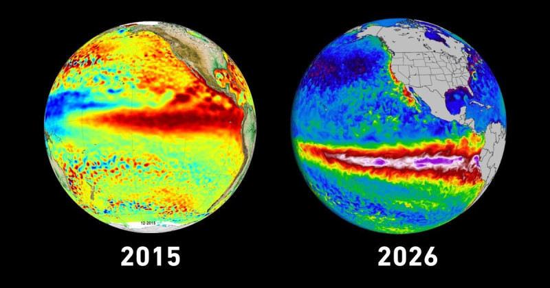
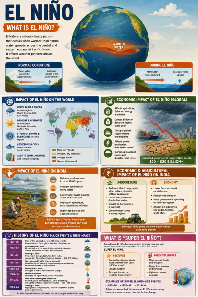
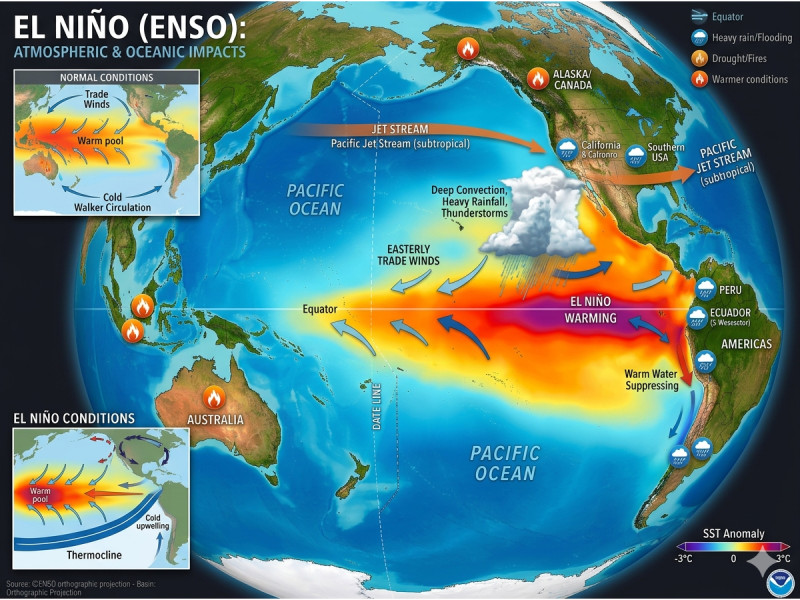
The El Niño–Southern Oscillation (ENSO) is a complex climate pattern that significantly influences global weather. It consists of two phases: El Niño, characterized by warmer-than-average sea surface temperatures in the central and eastern Pacific, and La Niña, which brings cooler-than-average temperatures to the same region. According to the latest NOAA report, there is a nearly 70% chance that the building Super El Niño will be the strongest such event on record.
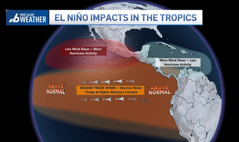
The Super El Niño map, released by NOAA, shows the anticipated impact zones and expected weather patterns for the upcoming winter. These maps are crucial tools for policymakers, farmers, and emergency management teams to prepare for potential extreme weather events. For instance, regions in the eastern Pacific are likely to experience increased storm activity, while areas in the Atlantic might see reduced tropical cyclone activity.
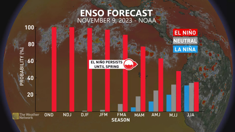
The latest ENSO Diagnostic Discussion highlights that El Niño is strengthening, with a greater than 90% chance of a very strong event, a sign that the Super El Niño is already shaping up to be a historic one.
Tracking the Intensity and Impact of the 2026 Super El Niño
According to the El Niño forecast, the current event is rapidly intensifying, driven by unusually strong westerly winds and subsurface ocean currents. This acceleration is pushing the 2026 event into historic territory, with the possibility of it becoming the most intense El Niño on record. The combination of these factors is causing a rapid escalation in sea surface temperatures and atmospheric anomalies, which are the key drivers of global weather patterns.
The Climate Prediction Center's ENSO Diagnostic Discussion indicates that El Niño is already showing significant strength, with a 90% chance of a very strong event during the Northern Hemisphere fall and winter of 2026-27. This suggests that the impacts of the Super El Niño will be felt far and wide, affecting everything from global agriculture to energy production and public health.
The Super El Niño Map and Its Implications for Global Weather
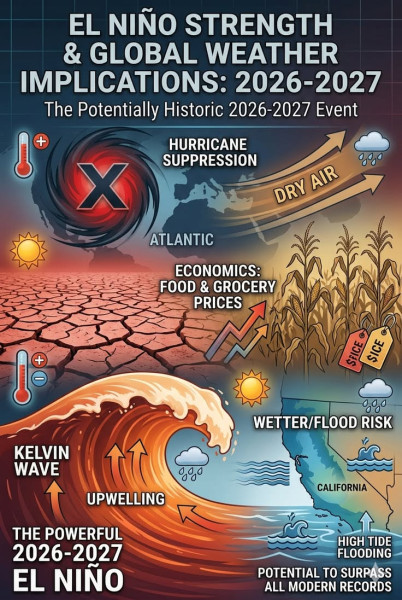
The latest Super El Niño map, updated in recent times, reveals a complex and potentially devastating picture. Regions expected to be most affected include the eastern and central Pacific, where increased storm activity and heavy rainfall are anticipated. Conversely, areas in the Atlantic and parts of Southeast Asia may experience drier conditions and reduced rainfall. The map also highlights the potential for widespread flooding and landslides in regions that are already at high risk, such as South America and parts of Southeast Asia.
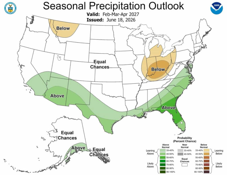
For instance, the map shows that the western United States could see increased precipitation, which could alleviate drought conditions in some areas but also pose risks of flooding and mudslides. Meanwhile, Southeast Asia and parts of Australia might experience below-average rainfall, leading to potential water shortages and agricultural challenges.
The Super El Niño event is setting up to be an extraordinary one, and the implications for global weather patterns are profound. The data is damning: we're looking at potential widespread disruptions, from increased storm activity in the Pacific to droughts in other regions. This is a wake-up call for governments and communities around the world to prepare for the challenges ahead.
Here’s what nobody's asking: how prepared are these regions for such extreme weather events? Coastal communities, already at risk from rising sea levels, could face even greater threats from storm surges and severe weather. This is a call to action for policymakers to invest in resilient infrastructure and emergency preparedness measures.
Let's not kid ourselves, the Super El Niño map is more than just a weather forecast; it's a call to action. As the world braces for the potential impacts of this historic event, it's crucial for governments, communities, and individuals to stay informed and prepared. By understanding the Super El Niño map and what it means for our future, we can take proactive steps to mitigate the risks and safeguard our planet's most vulnerable regions. The data is clear, and the stakes are higher than ever before.
How does this story make you feel?
 Up next · ScienceSuper El Niño Weather Changes Pose Challenges for Winter in 2026