Super El Niño 2026: The Looming Weather Wild Card
Here’s the thing: You’ve probably heard the buzz about super El Niño 2026 by now. It's more than just a weather pattern; it's a global phenomenon that could reshape how we experience the seasons, especially if you're in North America. The latest reports suggest we’re in for a wild ride, with temperatures soaring and weather patterns going haywire. And get this — it could even impact the 2026 World Cup weather. Let's dive in.
What is Super El Niño 2026 and Why Should We Care?
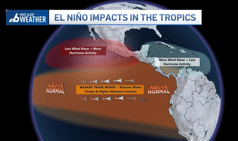
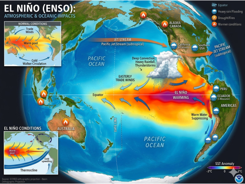
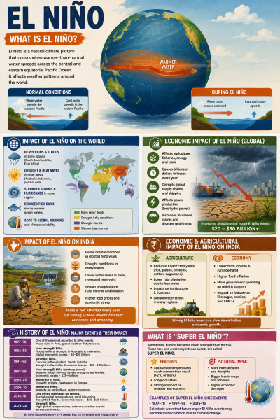
The term super El Niño 2026 might sound like something out of a sci-fi movie, but it's a very real and very powerful weather event. Essentially, it’s a massive "pressure release valve" for the piled-up warm water and energy in the Pacific. When this valve opens, it unleashes a high-energy event with strong, planetary impacts on weather, especially during the cold weather season over North America. It’s like nature’s way of saying, "Let’s reset the thermostat and see what happens."
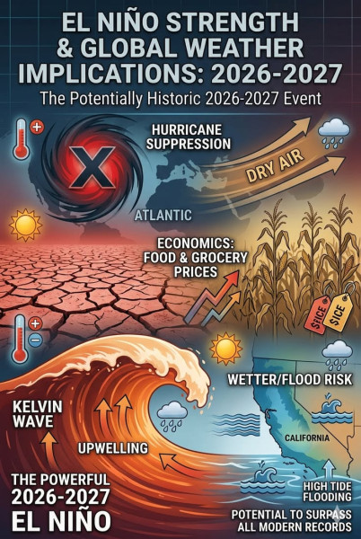
Look, it’s not just about the Pacific. This event is so intense that it could alter everything from heat and rain patterns to hurricanes. And if you’re a sports fan, you might be interested to know that it could also affect the 2026 World Cup weather. It’s a big deal, folks.
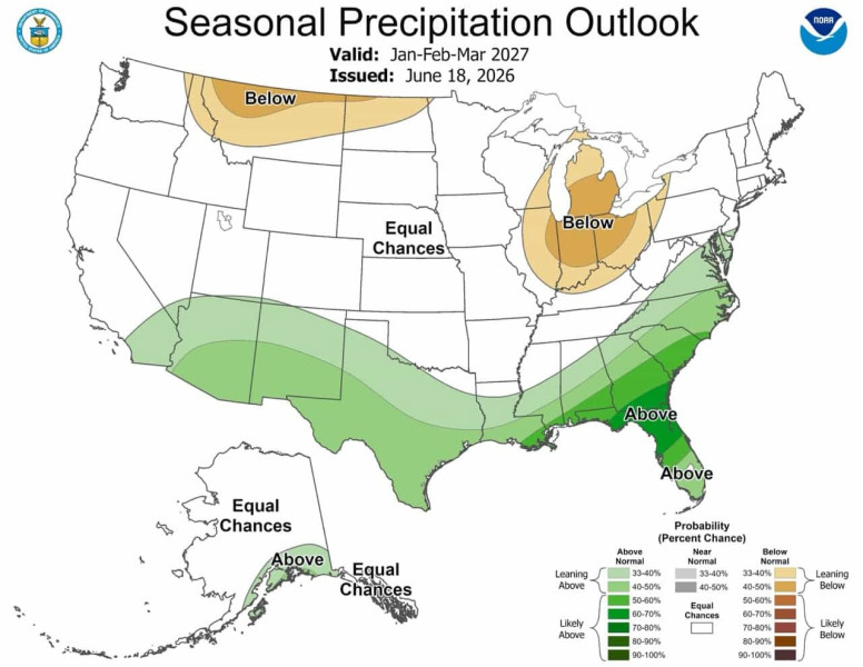
NOAA’s latest update confirms that El Niño has already arrived and is strengthening. There’s a chance it could become one of the most intense on record, which means North America could be in for some serious weather changes. The Climate Prediction Center’s three-month outlook shows above-average precipitation across the Southeast, as well as portions of the Four Corners and the Southwest from September to November. This is just the tip of the iceberg.
How Will Super El Niño 2026 Affect North America?
Expect the unexpected. That’s the mantra for super El Niño 2026 in North America this winter. The recent weather maps from NOAA show a stark picture of what’s to come. Above-average precipitation, unusual temperature swings, and a heightened risk of severe weather events are all on the table. NOAA's Super El Niño 2026-2027 winter weather map highlights the potential impacts, which could include everything from heavy snowfall in the Northeast to droughts in the West. Sound familiar? It should, considering the last time we had a Super El Niño it shook things up in a major way.
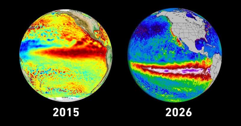
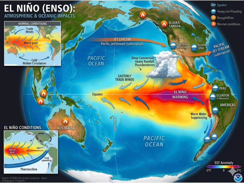
The current ENSO status, as well as the atmospheric conditions, are rapidly intensifying. This means the Pacific waters are warming up, and the atmosphere is responding in kind. Expect to see warmer temperatures, shifts in precipitation patterns, and possibly some unusual weather events that could catch us off guard. But remember, these are just general trends — the actual impacts could vary widely depending on your specific location.
Where Do We Go from Here?
As we head into the colder months, it’s crucial to stay informed and prepared. Super El Niño 2026 is not just a weather event; it’s a global phenomenon that could reshape how we experience the seasons. Keep an eye on the latest updates from NOAA and other reliable sources. Be ready for a winter unlike any other, and brace yourselves for the potential impacts on the 2026 World Cup and beyond. After all, this is one weather event that could genuinely alter the course of the upcoming year and beyond.
So, buckle up, folks. It’s going to be a wild ride. Consider the long-term impacts of this phenomenon on our planet and how we, as a global community, can adapt and mitigate its effects. Because, let’s face it, this is more than just weather — it’s a call to action.
How does this story make you feel?
 Up next · ScienceThe El Niño Influence: Uncovering the 2026-27 Winter Weather Predictions and Ski Season Outlook