El Niño–Southern Oscillation: Historic Event Brewing in the Pacific
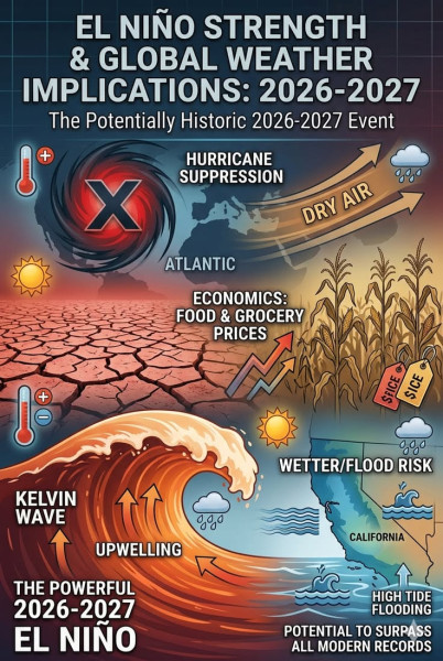
Look, if you've been hearing whispers about El Niño–Southern Oscillation (ENSO) and wondering what all the fuss is about, you’re not alone. It's trending right now because forecasters are sounding the alarm bells: a historic event might be on the horizon. The ENSO phenomenon, characterized by fluctuations in ocean temperatures in the Equatorial Pacific, is showing signs of becoming exceptionally strong, with significant implications for global weather patterns. And, with a greater than 90% chance of reaching unprecedented levels, it might be the strongest El Niño event the world has witnessed, according to the latest updates.
El Niño–Southern Oscillation: The Science Behind the Phenomenon
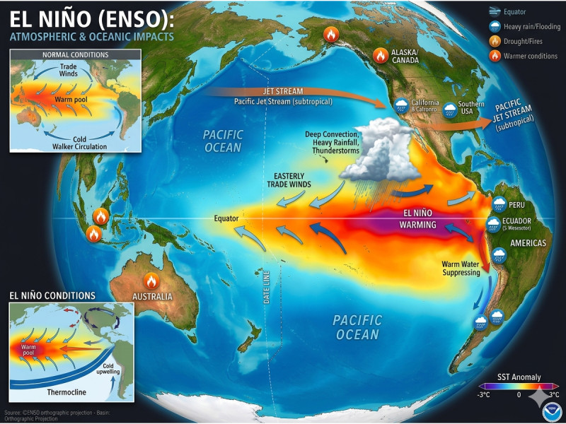
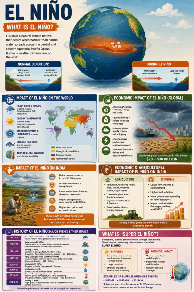
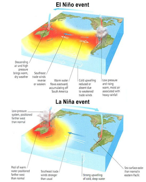
First, let's break down the basics. El Niño is the warm phase of the ENSO cycle, characterized by unusually high sea surface temperatures in the central and eastern tropical Pacific. This warming can lead to dramatic shifts in weather patterns worldwide, from increased rainfall in some regions to severe droughts in others. The current El Niño event, according to NOAA, has a 69% chance of reaching historic strength between October and December 2026. This is a significant development, as the last super-El Niño, in 2014-2016, caused widespread disruptions globally.
Here's the thing: the World Meteorological Organization (WMO) has been closely monitoring this phenomenon. Their latest update indicates an 80% likelihood of an El Niño event during the period from June through August, with probabilities for it to continue until at least November nearing or exceeding 90%. The WMO’s forecasts are crucial because they guide preparations for potential weather impacts, such as above-normal temperatures and extreme weather events.
If you're tracking the latest data, you might have noticed that the Niño 3.4 index, a key metric for monitoring El Niño, is intensifying rapidly. Currently, it stands at +2.6 °C, which is significantly above the 1991-2020 average. This makes the current El Niño one of the strongest on record, rivaling the 2014-2016 event.
Global Impact: What to Expect
So, what does this mean for us? Well, a strong El Niño can bring about a variety of weather extremes. For instance, regions like the Western Pacific and Indonesia could face severe droughts. Conversely, areas in the eastern Pacific, including parts of South America, might experience intense rainfall. But it's not just about precipitation. El Niño can also alter temperature patterns, leading to warmer-than-average conditions in many parts of the world.
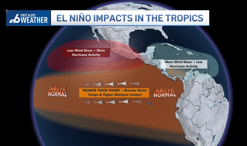
Over on the East Coast of the United States, fishermen and coastal communities are bracing for the impact. El Niño often brings warmer waters to the Eastern Pacific, which can disrupt marine ecosystems and fisheries. According to the latest WMO updates, tropical Atlantic sea surface temperatures are already showing signs of unusual warmth, which could exacerbate weather conditions in the region.
And get this — the UN’s weather agency has warned that the current El Niño could be the strongest on record. This means we might see some unprecedented weather events, from powerful storms to prolonged heatwaves. The UN News report highlights that while the full extent of the impacts is still uncertain, preparations are underway to mitigate potential disruptions.
Preparing for the Unpredictable
Forecasters and climate scientists are taking this El Niño very seriously. They stress that while there's always some uncertainty with weather forecasts, especially for events of this magnitude, the current data is alarming. The Climate Prediction Center updates its ENSO Diagnostic Discussions weekly, providing the latest updates on oceanic and atmospheric conditions. The next discussion, scheduled for September 10, 2026, will offer more insights into the developing situation.
The takeaway? Stay vigilant and prepared. Weather patterns are shifting rapidly, and while it's impossible to predict every detail, being informed can make a big difference. And if you're thinking about how this might affect you personally, consider the broader implications. This is a global event, and its effects will be felt far and wide.
El Niño–Southern Oscillation is not just a scientific phenomenon; it's a call to action. Communities and governments around the world are already gearing up for the challenges ahead. And, as always, the best strategy is to be informed, adapt, and prepare. Sound familiar? Remind you of anything?
El Niño–Southern Oscillation continues to shape our weather, and with this historic event on the horizon, it might just be the most dramatic in recent history.
How does this story make you feel?
 Up next · ScienceUnprecedented Super El Niño Could Drench San Antonio This Winter